
As such, it was recommended to increase real-time environmental monitoring and, to help achieve this, SIMBA units were deployed to help study the river ice thickness and contribute to the wider River Flood Forecasting System.
Four SIMBA units were deployed at set points along the river and fitted with flotation devices to aid retrieval at the end of each season.
The units autonomously return data every 6 hours, minimising the risk to personnel by reducing the number of visits onto the ice. The SIMBA units work alongside helicopter-mounted ground-penetrating radar and manual measurements to determine the river ice thickness throughout the season.
The SIMBA units have been retrieved and reused for multiple winter seasons, with thermistor chains and batteries being replenished as required.
To combat the faster-flowing river water, a wider thermistor chain was developed, providing additional strength and support. Since its creation, this wider chain has also been successfully used to study lake ice and snowpack properties.
Find out more about this project:
With thanks to C-CORE and the Government of Newfoundland and Labrador IceSight App.
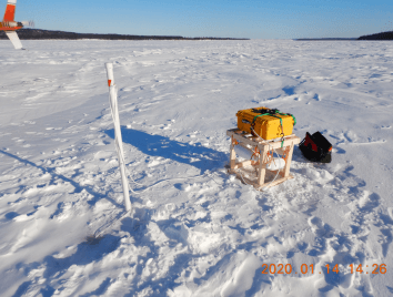
Photo credit: Churchill River Monitoring Project